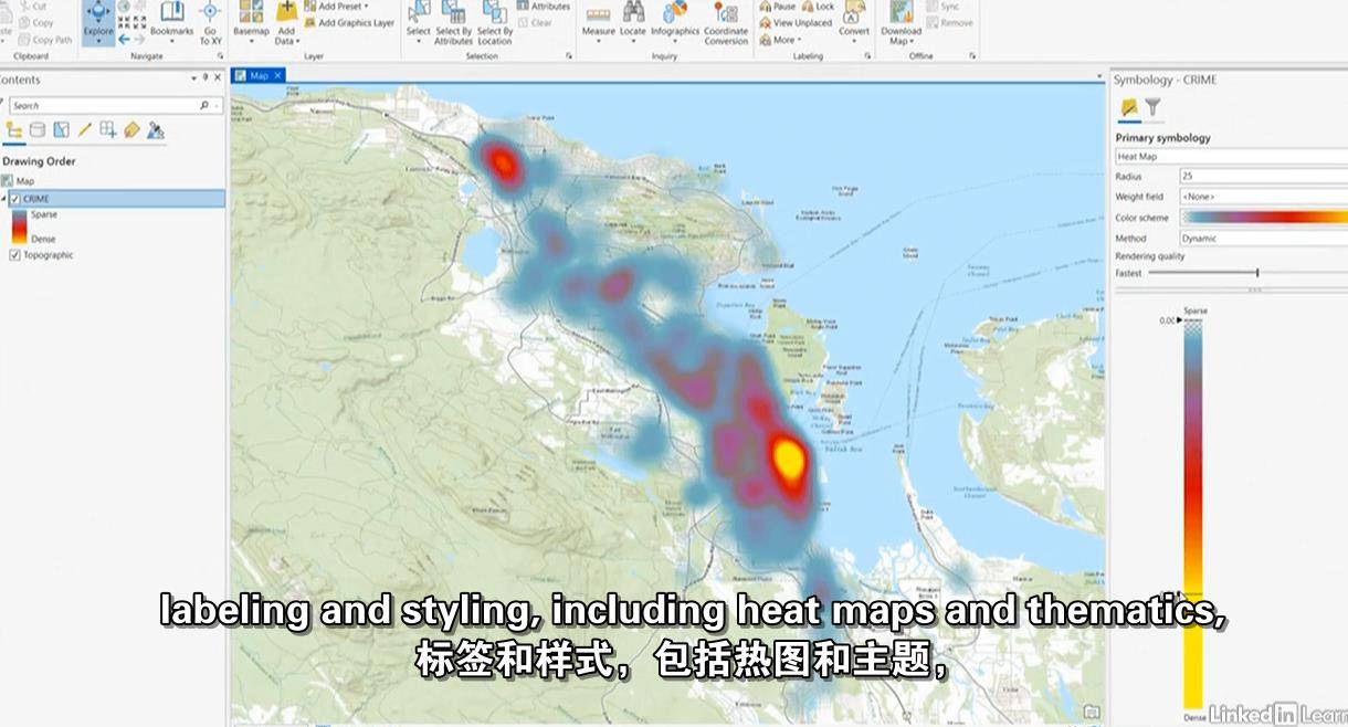
ArcGIS Pro是一种流行的地理信息系统(GIS ),它将2D和3D制图的强大功能与基于云的共享和协作功能相结合。版本2.4包含可视化和编辑增强,使它比以往任何时候都更强大。在本课程中,Gordon Luckett将向您介绍使用ArcGIS Pro 2.4的基本知识。Gordon向您展示了如何开始选择模板、创建工程、在ArcGIS Pro中导航以及设置工程和地图属性。他使用了矢量数据、栅格数据和样式数据。然后,Gordon将向您展示如何设计和标注地图。他解释了如何构建全球和本地3D场景,以及挤压建筑高度和将2D地图链接到您的3D场景。在讲述了如何打印地图布局之后,Gordon将深入研究如何创建要素类、绘制新数据、编辑要素属性等等。他讨论了如何使用地理空间工具、发布到ArcGIS online、共享单个文件或整个项目等。
MP4 |视频:h264,1280×720 |音频:AAC,44.1 KHz,2声道
技能级别:初学者|类型:电子学习|语言:英语+中英文字幕(云桥网络 机译) |时长:3小时17分钟|大小解压后:1.46 GB 含课程文件
MP4 | Video: h264, 1280×720 | Audio: AAC, 44.1 KHz, 2 Ch
Skill Level: Beginner | Genre: eLearning | Language: English + srt | Duration: 3h 17m | Size: 1.35 GB
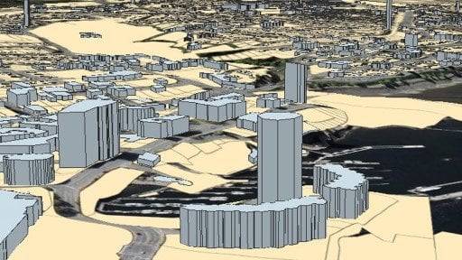
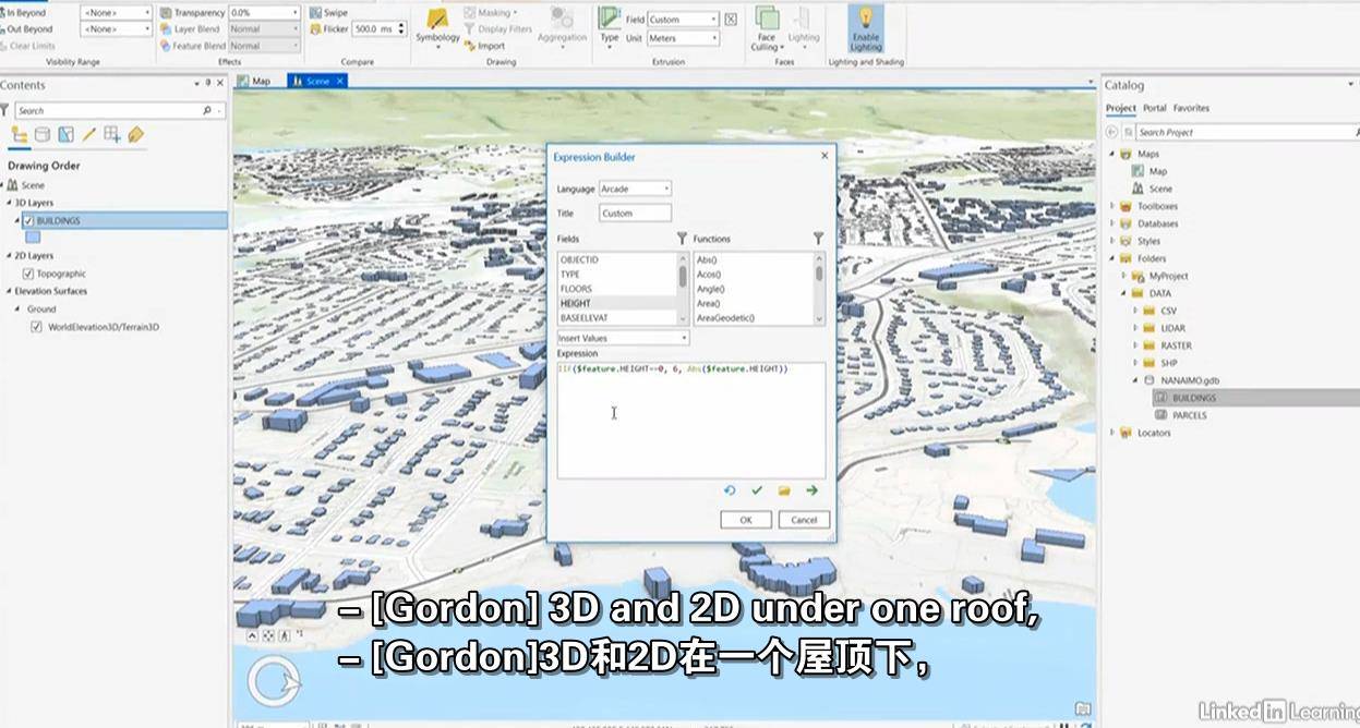
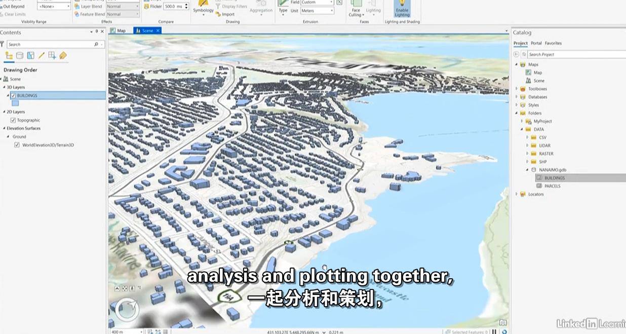
ArcGIS Pro is a popular geographic information system (GIS) that combines the power of 2D and 3D mapping with cloud-based sharing and collaboration features. Version 2.4 contains visualization and editing enhancements that make it more powerful than ever. In this course, Gordon Luckett teaches you the essentials of working with ArcGIS Pro 2.4. Gordon shows you how to get started with choosing a template, creating a project, navigating in ArcGIS Pro, and setting up project and map properties. He goes over using vector data, raster data, and styling data. Then Gordon shows you how to style and label your maps. He explains how to build global and local 3D scenes, as well as extrude building heights and link 2D maps to your 3D scenes. After covering how to print map layouts, Gordon dives into creating feature classes, drawing new data, editing feature attributes, and more. He discusses how to use geospatial tools, publish to ArcGIS online, share individual files or entire projects, and more.
云桥网络 为三维动画制作,游戏开发员、影视特效师等CG艺术家提供视频教程素材资源!
1、登录后,打赏30元成为VIP会员,全站资源免费获取!
2、资源默认为百度网盘链接,请用浏览器打开输入提取码不要有多余空格,如无法获取 请联系微信 yunqiaonet 补发。
3、分卷压缩包资源 需全部下载后解压第一个压缩包即可,下载过程不要强制中断 建议用winrar解压或360解压缩软件解压!
4、云桥网络平台所发布资源仅供用户自学自用,用户需以学习为目的,按需下载,严禁批量采集搬运共享资源等行为,望知悉!!!
5、云桥网络-CG数字艺术学习与资源分享平台,感谢您的赞赏与支持!平台所收取打赏费用仅作为平台服务器租赁及人员维护资金 费用不为素材本身费用,望理解知悉!